Import of Points
The program allows for data import in formats DXF, LandXML, ATLAS DMT and ASCII. When importing, all old data are deleted and replaced by the new ones. The world dimensions are automatically determined according to minimal and maximal values of coordinates x and y - it is therefore desirable to subsequently adjust the world dimensions in the frame "Basic data".
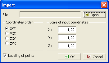
The program allows for importing ASCII data from respective files. Each point is written on a separate line of the file, coordinates are separated by space or tab character. If the file contains for each point first its name, it is necessary to check the item "Labeling of points". In the dialog window it is then necessary to specify the order of coordinates. If the data has an opposite sign convention, it possible to multiply the corresponding line by the value -1. The data import is performed after pressing the "OK" button.
 Dialog window "Import" - format "TXT"
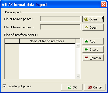
 Dialog window "Import" - format "Atlas"